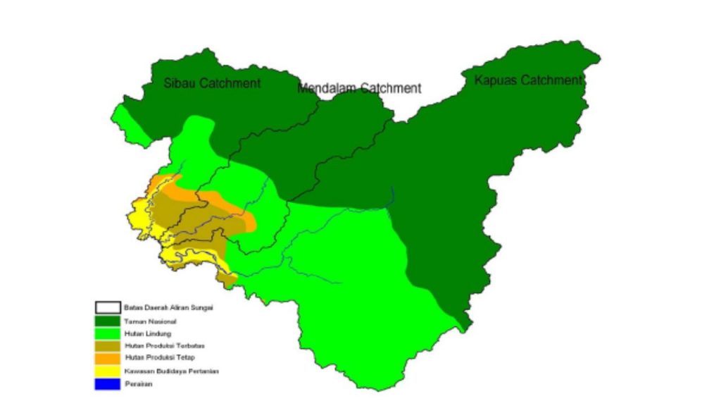
Geographically, Kapuas Hulu Regency lies on the northern area of West Borneo Province at 0°15′ – 1°25′ North Latitude dan 111°39′ – 114° 13′ East Longitude. Kapuas Hulu has wet climatic area of which 4,100 mm/year rain intensity (BMG Putussibau). Rain are evenly distributed within a year whereas November and December as the wettest month. 90 per cent of area are forest while another 3 per cent are agricultural land. There are three main sub-watersheds of Kapuas Hulu Watershed that is Sibau, Mendalam, and Kapuas (Koheng).
In the recent days, forested area of Kapuas Hulu is threatened by fire, massive (illegal) logging and mining. Generally, the decrease of forested area will affect ammount of water, its quality (erosion, sedimentation, polution) and furthermore, hydrologic functions of wathershed. As the problems continued, river transportation will be impacted as well. Erosion and sedimentation shallows the river hence this common transportation mean at the area disturbed.
Methodology
Watershed delineation are carried out using DEM and SRTM which is obtained from http:/srtm.csi.cgiar.org//. The following table denote the data used :
Table 1. Data SRTM-DEM used as basic of wathershed delineation
| Kind of Data | Data | Position | Year |
| SRTM 90m DEM | srtm_59_12 | Latitude 2.50 N
Longitude 117.50 E |
2004 |
| SRTM 90m DEM | srtm_59_13 | Latitude 2.50 S
Longitude 112.50 E |
2004 |
Delineation of watershed uses topographic, hydrologic, vegetative, and social features. Slope analysis is used to determine how elevation interacts with drainage system. At the later time, watershed area divide as three part as upper, middle, and lower by using criteria as mentioned below :
Table 2. Characteristic of whatershed part.
| Characteristic | Upper Stream | Middle Stream | Lower Stream |
| Slope | > 40 % | 15 – 40 % | < 15 % |
| Land-use Type | Forest/Conservation Area | Limited Cultivation/Plantation | Intensive agricultural land |
| Hydrologic Process | Mostly Erosion | Equal Erosion-Sedimentation | Mostly Sedimentation |
| Community Employment | Hunting and Collecting society | Semi-permanent agriculture society | Permanent agriculture society |
Result and Discussion
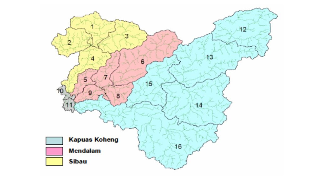
From DEM analysis, watershed delineation including its sub-watershed area is depicted in the figure below :
Hydrologic problems of Kapuas Hulu Watershed mostly correlated with water quantity and quality. Illegal mining and excessive logging are problems faced by the community. Mercury using at the mining has been polluting the river and threatening people on the riverside. Fluctuation of water flow, erosion and sedimentation also the main problem in the lower stream area. The decrease of water level engages serious problem for transportation as people usually use river as their main path of transportation.
Table 3. Hydrologic problems of Sibau, Mendalam, Kapuas Koheng Sub-Watershed
| Problem | SIbau | Mendalam | Kapuas |
| Hydrologic problem | Charge fluctuation, turbidity, erosion, sedimentation, pollution, slide, river path expansion | ||
| Cause | High precipitation intensity, extensive cutting, over fishing (poisoning), gold mining, dometic waste, riverbank degradasion | ||
| Impact | Transportation problem, biodiversity and fish population decrease, community health problem, drought at dry-season | ||