SIMPLE MODEL FOR TSUNAMI HAZARDS ESTIMATION

SIMPLE MODEL FOR TSUNAMI HAZARDS ESTIMATION

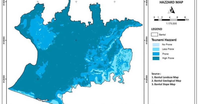
SIMPLE MODEL FOR TSUNAMI HAZARDS ESTIMATION - CASE STUDY : BANTUL REGENCY, YOGYAKARTA PROVINCE - A tsunami (pronounced sue-nahm-ee) is a series of huge waves that can cause great devastation and loss of life when they strike a coast.Tsunamis are caused by an underwater earthquake, a volcanic eruption, an sub-marine rockslide, or, more rarely, by an asteroid or meteoroid crashing into in the water from space. Most tsunamis are caused by underwater earthquakes, but not all underwater earthquakes cause tsunamis - an earthquake has to be over about magnitude 6.75 on the Richter scale for it to cause a tsunami. About 90 percent of all tsunamis occur in the Pacific Ocean The word tsunami comes from the Japanese word meaning "harbor wave." Tsunamis are sometimes incorrectly called "tidal waves" -- tsunamis are not caused by the tides (tides are caused by the gravitational force of the moon on the sea). Regular waves are caused by the wind. A tsunami starts when a huge...
Read More
HOW TO ESTIMATE LANDSLIDE HAZARDS USING SIMPLE MODEL?

HOW TO ESTIMATE LANDSLIDE HAZARDS USING SIMPLE MODEL?

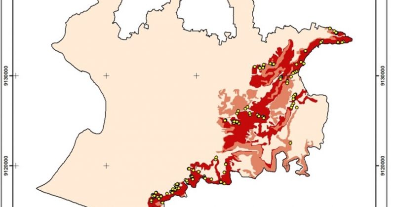
HOW TO ESTIMATE LANDSLIDE HAZARDS USING SIMPLE MODEL? CASE STUDY OF BANTUL REGENCY, YOGYAKARTA PROVINCE   A landslide or landslip is a geological phenomenon which includes a wide range of ground movement, such as rock falls, deep failure of slopes and shallow debris flows, which can occur in offshore, coastal and onshore environments. Although the action of gravity is the primary driving force for a landslide to occur, there are other contributing factors affecting the original slope stability. Typically, pre-conditional factors build up specific sub-surface conditions that make the area/slope prone to failure, whereas the actual landslide often requires a trigger before being released. Landslides occur when the stability of a slope changes from a stable to an unstable condition. A change in the stability of a slope can be caused by a number of factors, acting together or alone. Natural causes of landslides include: groundwater (porewater) pressure acting to destabilize the slope loss or absence of vertical vegetative structure, soil nutrients, and soil...
Read More

Referensi Review “Merapi, History and Future Changes”

"Merapi, History and Future Changes" will be found in here. The review was published in two article, which were here and here. This resume is based on articles on scientific journal as mentioned below : Voight, E.K. Constantine, S. Siswowidjoyo, R. Torley., Historical eruptions of Merapi Volcano, Central Java, Indonesia, 1768–1998; Journal of Volcanology and Geothermal Research 100 (2000) 69–138 C.G. Newhall, S. Bronto, B. Alloway, N.G. Banks, I. Bahar, M.A. del Marmol, R.D. Hadisantono, R.T. Holcomb, J. McGeehin, J.N. Miksic, M. Rubin, S.D. Sayudi, R. Sukhyar, S. Andreastuti, R.I. Tilling, R. Torley, D. Trimble, A.D. Wirakusumah, 10,000 Years of explosive eruptions of Merapi Volcano,Central Java: archaeological and modern implications; Journal of Volcanology and Geothermal Research 100 (2000) 9–50 Lavigne, J.C. Thouret, B. Voight, H. Suwa, A. Sumaryono., Lahars at Merapi volcano, Central Java: an overview, Journal of Volcanology and Geothermal Research 100 (2000) 423–456 Camus, A. Gourgaud, P.-C. Mossand-Berthommier, P.-M. Vincent, Merapi (Central Java, Indonesia): An outline of the...
Read More
Stratigraphy and Radiocarbon Dating of Pyroclastic Deposits at Merapi Volcano

Stratigraphy and Radiocarbon Dating of Pyroclastic Deposits at Merapi Volcano

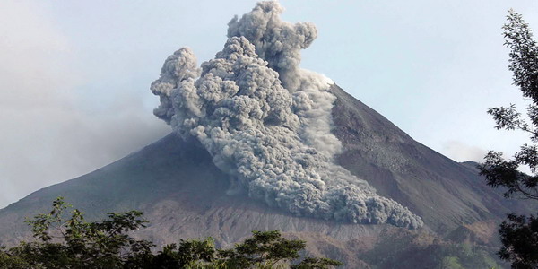
Stratigraphy and radiocarbon dating of pyroclastic deposits at Merapi Volcano, Central Java, reveals ,10,000 years of explosive eruptions. Highlights include: (1) Construction of an Old Merapi stratovolcano to the height of the present cone or slightly higher. Our oldest age for an explosive eruption is 9630 ± 6014 C y B.P.; construction of Old Merapi certainly began earlier. (2) Collapse(s) of Old Merapi that left a somma rim high on its eastern slope and sent one or more debris avalanche(s) down its southern and western flanks. Impoundment of Kali Progo to form an early Lake Borobudur at ~3400 14C y B.P. hints at a possible early collapse of Merapi. The latest somma-forming collapse occurred ~1900 14C y B.P. The current cone, New Merapi, began to grow soon thereafter. (3) Several large and many small Buddhist and Hindu temples were constructed in Central Java between 732 and ~900 A.D. (roughly, 1400–1000 c y B.P.). Explosive Merapi eruptions occurred before, during and after temple construction....
Read More
Merapi, History and Future Changes

Merapi, History and Future Changes

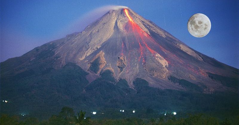
A Working Paper Merapi, History and Future Changes - Merapi Volcano, in the central part of Java, is regarded as the most active and most dangerous volcano in Indonesia. Merapi is a young stratovolcano with a total volume estimated between about 100 and 150 km3, according to the importance given to the Pre-Merapi (Berthommier, 1990). A strong uncertainty remains concerning the beginning of its activity. Information on Merapi eruptive activity is scattered. A concise and well-documented summary of this activity has been long needed to assist researchers and hazard-mitigation efforts. The present effusion rate is about 105 m3/month (Siswowidjoyo et al., 1995); if we assume a constant rate since the beginning, Mount Merapi could be between 8300 and 125 000 years old. On the basis of field studies and geochronological data, its history is divided into four Periods: Ancient, Middle, Recent and Modern Merapi. The Ancient Period may have begun around 40 000 y BP and lasted until 14 000 y...
Read More