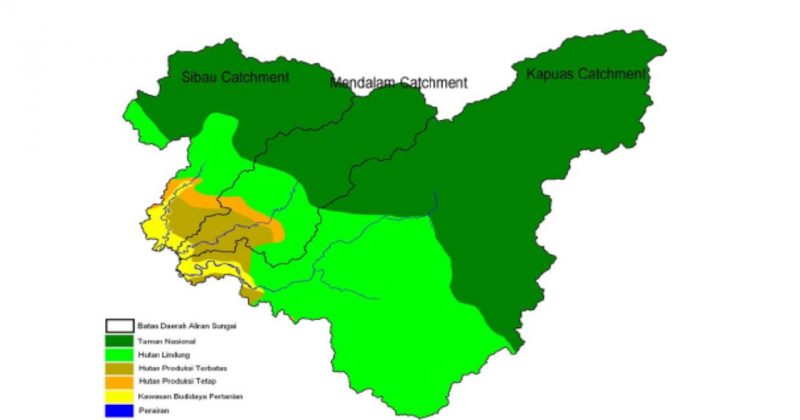
How to Delineate Watershed ? Case study : Kapuas Hulu Watershed
Geographically, Kapuas Hulu Regency lies on the northern area of West Borneo Province at 0°15' – 1°25' North Latitude dan 111°39' – 114° 13' East Longitude. Kapuas Hulu has wet climatic area of which 4,100 mm/year rain intensity (BMG Putussibau). Rain are evenly distributed within a year whereas November and December as the wettest month. 90 per cent of area are forest while another 3 per cent are agricultural land. There are three main sub-watersheds of Kapuas Hulu Watershed that is Sibau, Mendalam, and Kapuas (Koheng).
In the recent days, forested area of Kapuas Hulu is threatened by fire, massive (illegal) logging and mining. Generally, the decrease of forested area will affect ammount of water, its quality (erosion, sedimentation, polution) and furthermore, hydrologic functions of wathershed. As the problems continued, river transportation will be impacted as well. Erosion and sedimentation shallows the river hence this common transportation mean at the area disturbed.
Methodology
Watershed delineation are carried out using DEM and SRTM which...