Integrating GIS into Forest Resources Spatial Management and Planning (5.1) – Participatory GIS (PGIS) for Community Based Natural Resources Management (Case Study in Tinto, Cameroon) (continued)
This article is summarized and concluded from articles as follow:
(1) Making GIS Work in Forest Management by Manij Upadhyay, unpublished work.
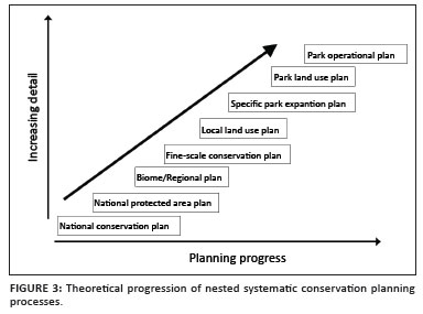
(2) A Hierarchical Approach to Spatial Forest Planning by Ugo Feunekes and Andrew Cogswell, USDA Forest Service, Proceeding
(3) HCVF/A Identify Within Ecoregion; Integrating Conservation Planning into Regional Spatial Planning by Barano Siswa Sulistyawan, WWF Indonesia,
(4) Assessing participatory GIS for community-based natural resources management: claiming community forests in Cameroon by Michael K. McCall and Peter A. Minang, The Geography Journal Volume 171 No.(4) pages 283-306, 2010
Previous Section - Participatory GIS (PGIS) for Community Based Natural Resources Management (Case Study in Tinto, Cameroon)
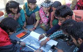
Participatory GIS (PGIS) for Community Based Natural Resources Management (Case Study in Tinto, Cameroon) (continued)
Integrating GIS into Forest Resources Spatial Management and Planning (5.1) -- Participatory spatial planning, in its various manifestations, demonstrates the common ‘imperfect data’ characteristics of ‘naïve geography’ (Egenhofer and Mark 1995):
fuzzy and layered zones and zonal information (area data);
simultaneity of views and ‘jumping scale’ – people’s consciousness and cognition operate at several spatial scales...